

LEARN BIOME BASICS TO HIKE IN AMERICA’S 6 DIVERSE ENVIRONMENTS
Ever been on the trail in one part of the country and felt you had everything you needed, only to bring that same trusty setup to a different region and feel woefully unprepared?
Maybe you’re used to hiking the Pacific Northwest, so you’re always stocked with extra socks for when the ceaseless drizzle puts your waterproof boots to the test. Maybe you skimp on carried water because you know the next stream is just around the bend. While extra socks usually aren’t a bad thing, that water strategy certainly won’t be adequate for the deserts of the Southwest. Each region requires a different plan of attack.
According to National Geographic, a biome is characterized by its vegetation, soil, climate, and wildlife. Though there are various sub-categories within America’s biomes, there are six main environments in which you will likely find yourself if you set out on a hike. The trail conditions of each environment will vary significantly, and each will require different gear.
Here, we break down the best time to hike in each biome, as well as each biome’s unique hazards and advantages.
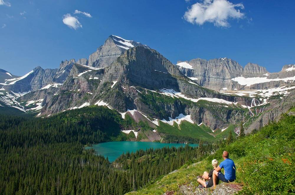
DECIDUOUS FOREST
Region: East & Southeast
Spanning nearly half of the United States, the temperate deciduous forest is one of the most diverse biomes. To be categorized as a deciduous forest, the region must experience four distinct seasons, characterized by low precipitation and cold temperatures in the winter and warm, humid summers.
Abundant rainfall allows these areas to thrive with broadleaf trees such as oak, hickory, maple, and beech. The dynamic terrain is home to an abundance of species, but the main ones to be mindful of when hiking here are black bears (though they mostly avoid hikers unless provoked), and venomous snakes such as timber rattlesnakes, cottonmouths, and copperheads.
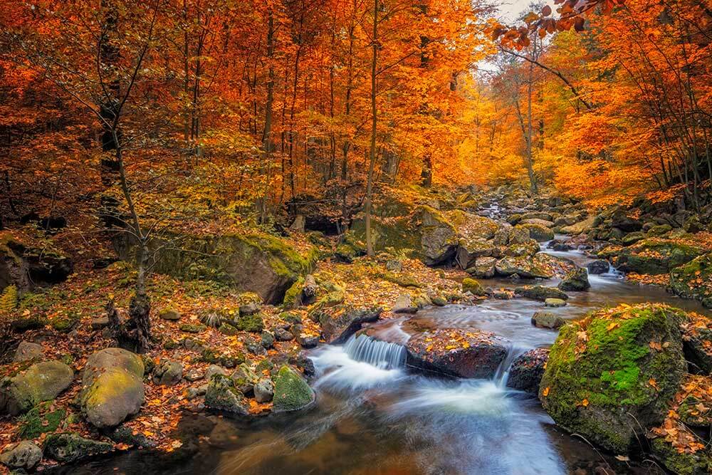
The climate in this region varies greatly, as the area encompasses all states between Maine and Florida and from Arkansas to the Atlantic. Because of this, you will have to be prepared for weather on a state-by-state basis and pack layers that will accommodate a broad range of conditions.
The terrain features anything from the mountains of Appalachia to river valleys, coastal forests, and swamps, so be prepared for lots of ascents and descents if you plan on hiking a long section. If you hike in the summer, prepare for rain and pesky insects such as disease-carrying ticks, black flies, and mosquitoes.
At a Glance
Best time to hike: April-June, September-October
Watch out for: stream crossings, black bears, snakes, varied weather, ticks
Enjoy: rich plant life, water sources, amenities/civilization never too far
3 trail recommendations:
- The Gothics via Lower and Upper Wolfjaw Mountain (Adirondacks, NY) – 15.2-mile loop, difficult;
- Old Rag Mountain Loop (Shenandoah, VA) – 9.5-mile loop, difficult;
- Jacks River Trail (Cohutta Wilderness, GA) – 9.3-mile in-and-out, difficult
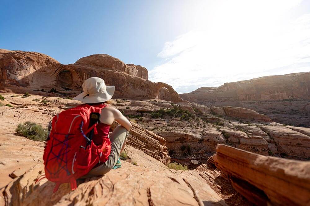
DESERT
Region: Southwest & Western Texas
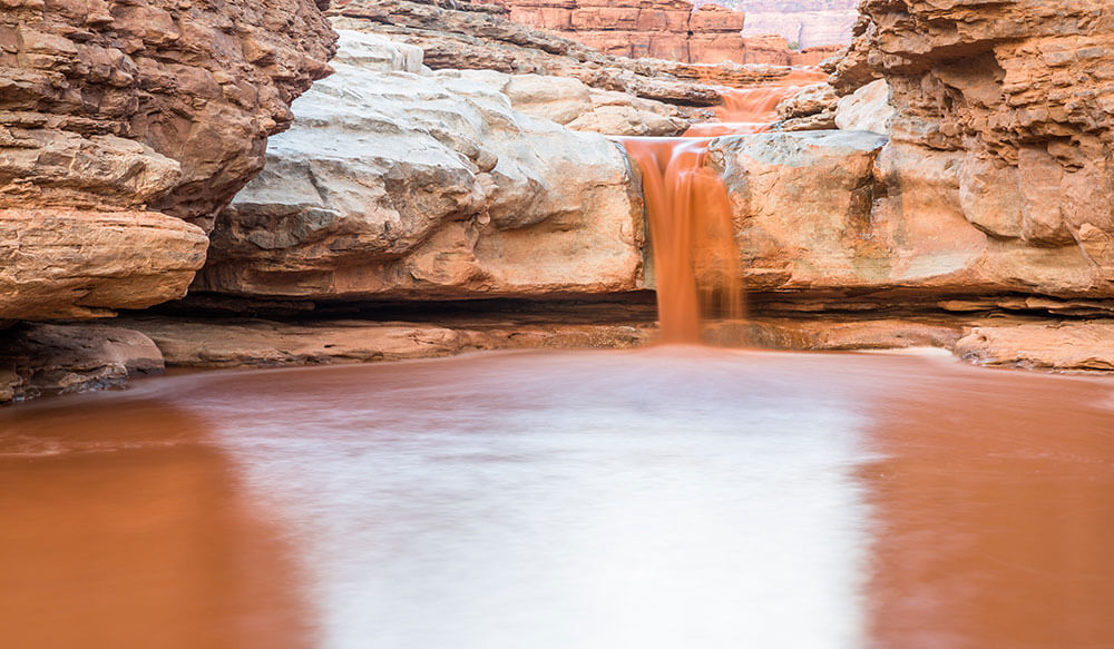
The desert is a place of extremes. Extreme heat in the day, extreme cold in the night, and extreme beauty. Deserts cover one-fifth of Earth’s surface, and more of the U.S. than you might think, due to how varied they are in appearance. While hiking America’s deserts can be awe-inspiring, such places require more careful planning and considerations than most other biomes.
PAOLO CIPRIANI / ISTOCK PHOTO
Water will be your biggest concern, and in more ways than you may know. Hiking in a desert demands a large hydration reservoir, since you ought to aim for drinking a gallon a day. Salty snacks are also a must, as they help you retain precious water. Another water concern comes from the sky; believe it or not, the desert experiences a monsoon season between June and mid-September. Beware of flash floods (especially while exploring slot canyons) any time of year, but especially if you’re hiking during that period.
The other major consideration is sun protection, and while you may use sunscreen if you must, try simply wearing a wide-brimmed hat and light, breathable clothing that covers your arms and legs to cut down on weight and chemicals. You’ll probably want to opt for close-toed shoes, but make sure you pack a set of tweezers for cacti removal, regardless. Dangers here come in smaller sizes than in most places; no large animals will mess with you, but keep your eyes peeled for snakes and scorpions.
At a Glance
Best time to hike: March-May
Hazards: water sources, extreme temperatures, snakes, scorpions, cacti
Advantages: surreal rock formations, less clothing and gear to bring
3 trail recommendations:
- The Wave (Paria Canyon-Vermillon Cliffs Wilderness Area, UT) – 3-mile in-and-out, easy);
- Coal Mine Canyon (Tuba City, AZ) – 3-mile in-and-out, moderate;
- South Rim Trail (Big Bend, TX) – 12.6-mile in-and-out, difficult
GRASSLAND
Region: Great Plains/Midwest
The Great Plains may be the most underrated region in which to hike, yet it covers arguably the largest portion of America. In this part of the world, there are fewer seasons you can hike comfortably, unless you’re into cold-weather camping. The grasslands are characterized by amber waves of grain (prairies), arid steppes, and rolling hills—sometimes blanketed with coniferous forests, but mostly, well, grasses. They experience long, cold winters and hot, dry summers. You will most likely want to hike these areas in the early summer or early fall, as summer can be too hot for comfort and bring a mess of unruly weather.
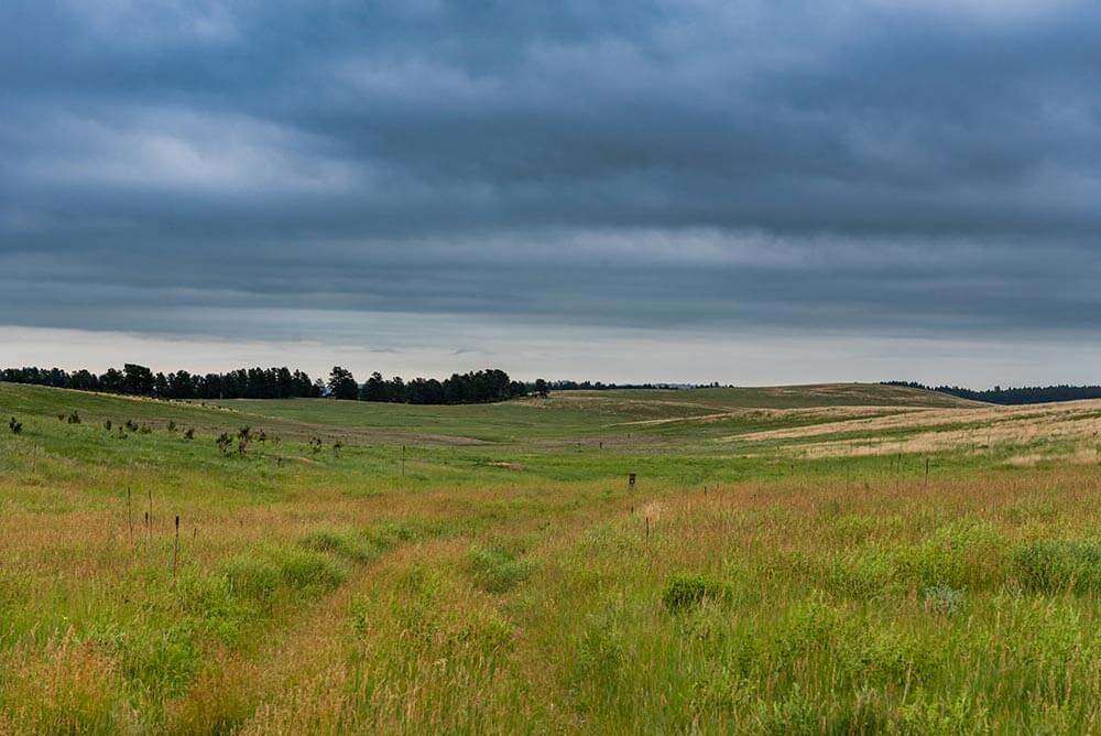
Like in the desert, water considerations will be key in the grasslands. Water sources are few and far between, though the spring will bring a rush of snow-melt to engorge the streams you do encounter. Another big consideration is wind.
Without many trees or mountains to shelter you, the wind may become a constant companion. If the wind bothers your ears, opt for a hat or buff that will cover them. You’ll also want thin glove liners, as the mornings are quite cold, and close-toed shoes you can tuck your pants into if traversing overgrown areas (ticks and chiggers are a big concern in the summer).
“SOUTH DAKOTA IS KNOWN FOR HAVING THE WORLD’S LARGEST HAILSTONE, AND THE QUICKEST CHANGE IN WEATHER.”
Though one of the boons of this region is that it is less populated and offers more solitude on the trail, that same feature can also make navigation challenging. Not all trails are well-marked or maintained, so be sure to bring navigation tools and learn the area.
Summer may offer the greatest wildlife-viewing opportunities, but it will also bring thunderstorms and hail in some parts (South Dakota is known for having the world’s largest hailstone, and the quickest change in weather).
At a Glance
Best time to hike: May-June, September
Hazards: thunderstorms, ticks, hail, freak snow in shoulder seasons
Advantages: solitude, wildlife, sprawling vistas
3 trail recommendations:
- Centennial Trail (Black Hills, SD) – 111-mile in-and-out, easy;
- Red Beds Trail (Devils Tower, WY) – 3-mile in-and-out, easy;
- Bison Trail (High Great Plains, NE) – 6-mile in-and-out, easy
TAIGA
Region: Western Montana, Northern Idaho, Southern Alaska
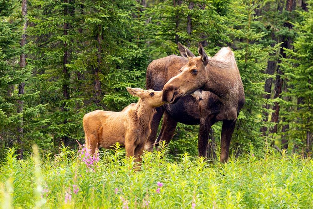
Also known as a boreal forest, the taiga is basically a northern, subarctic forest. Cool and moist, the taiga is dominated by coniferous trees, and though poor soil makes for weak growing conditions for plant life, these forests are bursting with animal life such as elk, grizzly bears, wolves, and caribou. Like temperate forests, the taiga receives plentiful precipitation, though this translates to snow rather than rain due to the higher altitude.
Although this biome is one of the most expansive in the world (think Canada, Siberia, and Scandinavia), it only appears in two places in the U.S.: Southern Alaska and near Glacier National Park.
CHRIS BOSWELL / ISTOCK PHOTO
When hiking the taiga, water is likely to be readily available, as this region is dotted with alpine lakes and many streams. While those mountain lakes may look tempting, especially in the summer, be wary: many of these lakes are fed by glacial water and hypothermia can be a real danger.
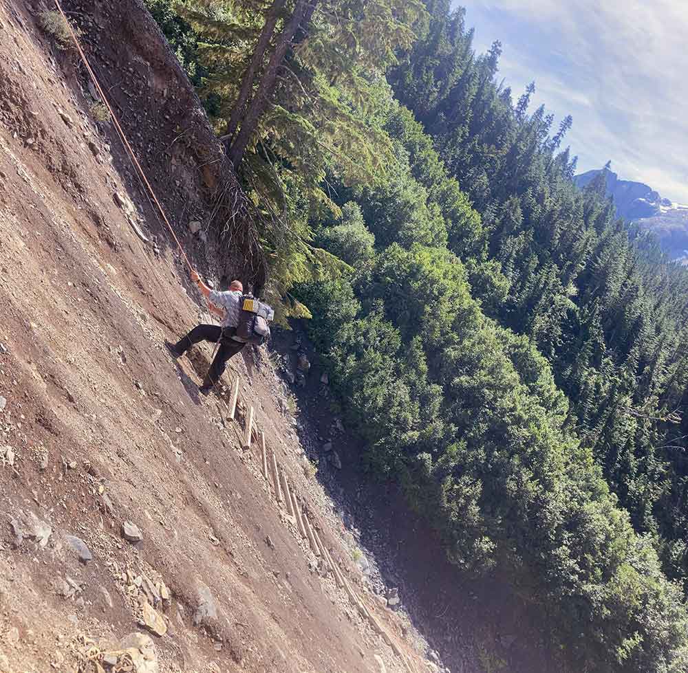
In places such as Glacier National Park in Montana, avalanches are fairly common, especially in spring and early summer, so be cautious. In areas this steep and rugged, one of the main accidents is falling, so wear shoes with good tread and consider trekking poles.
Since you will most likely be hiking in the summer, be prepared for an onslaught of bugs. Repellent, proper clothing, and a head net will help keep you sane.
At a Glance
Best time to hike: July-September
Hazards: moose, grizzlies, hypothermia, steep terrain, snow and ice
Advantages: lakes and streams for fishing, wildflowers, water sources
3 trail recommendations:
- Fish Lake Trail (Selway-Bitterroot Wilderness, ID) – 8.4-mile in-and-out, moderate;
- Grinnell Glacier Trail (Glacier National Park, MT) – 10.6-mile in-and-out, difficult;
- Taiga Trail (Denali National Park, AK) – 1.5-mile in-and-out, easy
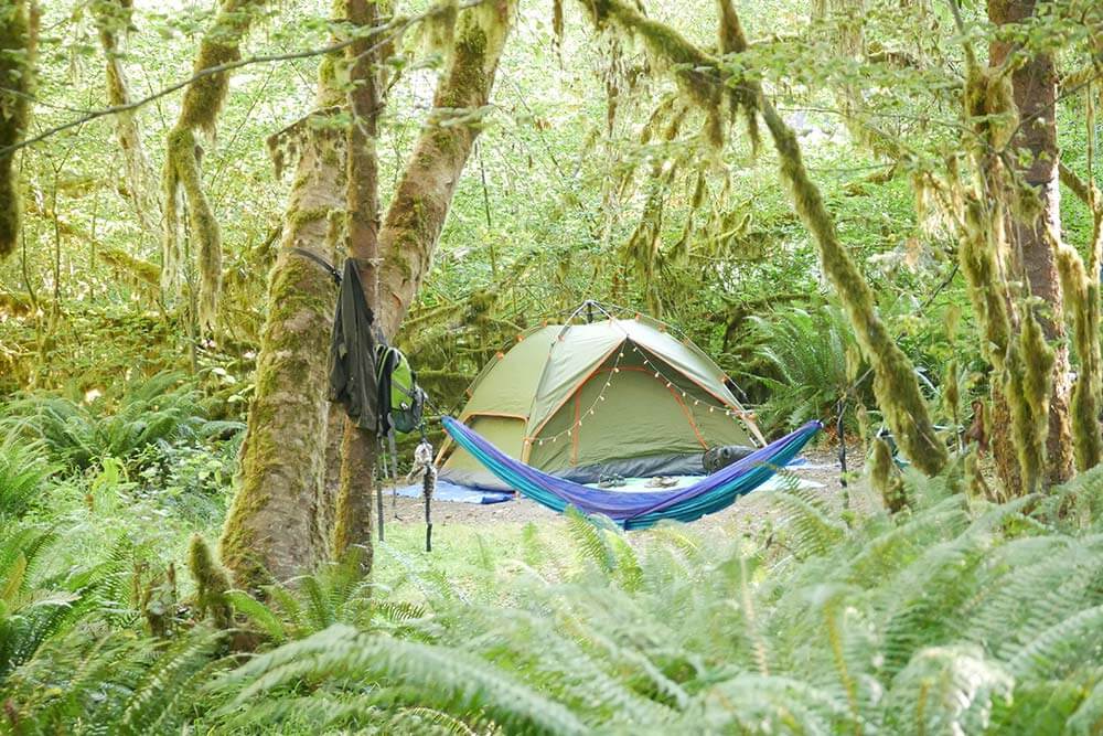
TEMPERATE RAIN FOREST
Region: Pacific Northwest
You know what’s coming with this one: rain. However, contrary to popular belief, you will hardly ever encounter rain in this biome during the summer months; the majority of precipitation besets Western Washington and Oregon the other 12 months of the year.
While much of the Pacific Northwest shares characteristics with both the taiga and deciduous forests, Olympic National Park in Washington is home to a true temperate rain forest: the Hoh Rain Forest, which receives an average of 12-14 feet of rain annually.
Temperate rain forests experience mild winters and cool summers, which is one reason hiking is so popular in this area. It is one of the few places in the U.S. where you can hike year-round.
Four seasons of hiking also mean this region can get pretty crowded, especially around Seattle and Portland. Even when you think you’re out in the sticks, you will likely see another hiker on your trip, which can be a good or bad thing, depending on your preference. The popularity of this area also means there are hundreds of trails, and most are well-marked and well-maintained.
However, you should always check trail conditions online or at a ranger station before heading out: trails in this area are prone to wash-outs, and many places in the mountains still have formidable snow until July or August.
If you choose to hike in the summer, bring light rain gear just in case, but chances are you won’t need it. The rest of the year, reliable waterproof gear is a must. Opt for a wide-brimmed waterproof hat, which can come in handy in conjunction with a head net in late spring and late summer, when mosquitoes will be swarming the lakes and shaded areas.
When hiking in the cooler months, be sure you have a strategy for staying warm and dry. The mild climate can be deceiving; while hiking, the mid-40s temperature won’t be bothersome, but if your clothes are wet and you can’t get warm, hypothermia can become a concern.
At a Glance
Best time to hike: July-October
Hazards: rain (not in summer), widow-makers, lots of rules/permits/etc. (popular hiking, delicate landscape), washed-out trails
Advantages: mushrooms in fall, water sources, shade, bountiful trails (usually well-marked)
3 trail recommendations:
- Royal Basin (Olympic Peninsula, WA) – 16-mile in-and-out, moderate;
- Hoh River Trail (Olympic National Park, WA) – 33-mile in-and-out, easy;
- Hart’s Cove (Cascade Head Scenic Research Area, OR) –7-mile in-and-out, moderate
TUNDRA
Region: Northern Alaska
It’s no secret that the Land of the Midnight Sun is home to one of the most vast, pristine wildernesses in the world. Such a wild place is unsurprisingly marked by many hazards—and beauties—you won’t find anywhere else in America.
Northern Alaska in the only place in the U.S. where you will find tundra, a biome branded by its lack of trees (as it is above treeline), spongy wetlands that freeze in the winter, short summers, and long, harsh winters.
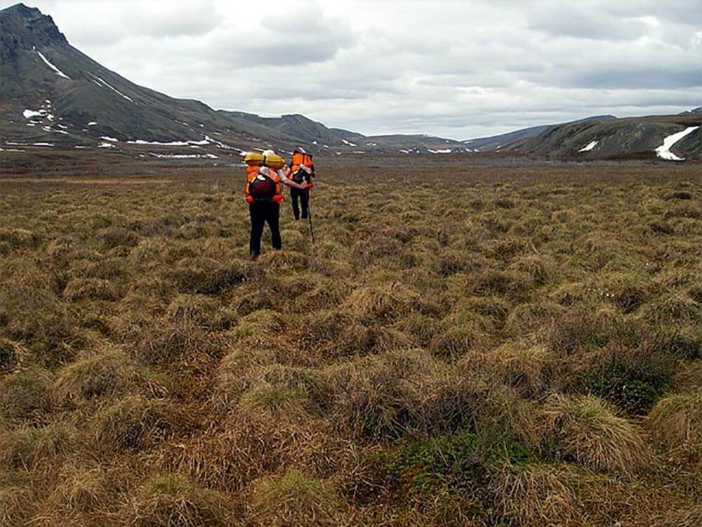
If you ever become enticed by this unusual landscape, you will most likely want to visit in the summer (unless you are an experienced survivalist), when the extra-long days provide more hiking hours. You’ll need those hours in the tundra; hiking here is more arduous than other places—an experienced hiker will deem six miles a day in this rugged country as an accomplishment.
The terrain here is covered in tussocks (small, grassy mounds that feel akin to walking on basketballs) and streams, so give yourself a break and pack trekking poles.
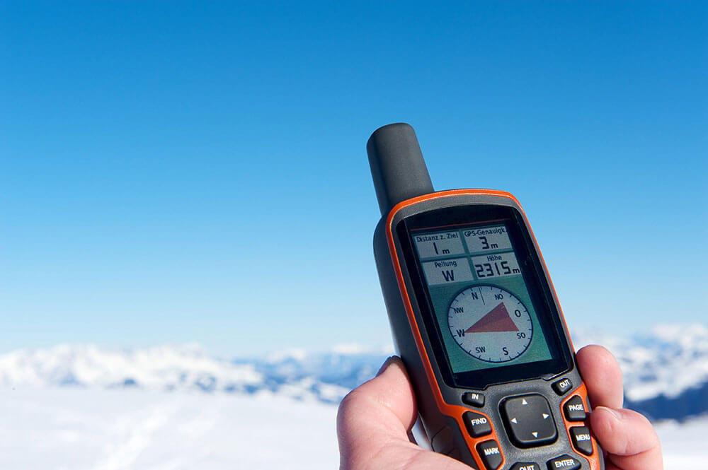
As you might expect, the tundra is largely unmarked (such as in Gates of the Arctic National Park): there won’t be many roads or any established trails to guide you, so make sure you bring proper navigational tools. A satellite communication device will be essential.
No matter when you go, be wary of wildlife here, especially bears. Due to the lack of trees, you will probably need to bring a bear canister instead of hanging your food. It should go without saying, but bury any toothpaste spit or other things that come out of you, and keep anything scented far away from your tent. You’ll want a warm sleeping bag, too—even in the summer. Make sure it’s rated for at least 10-40 degrees, and bring a sleeping pad to keep you off the cold permafrost.
“SOME PEOPLE JOKE THAT ALASKA’S STATE BIRD IS THE MOSQUITO, AND FOR GOOD REASON.”
The problem with visiting in the summer is the mosquitoes. Some people joke that Alaska’s state bird is the mosquito, and for good reason. In some areas, you could be covered in a hundred mosquitoes in seconds, so insect repellent, proper clothing, and head nets are a must. Or, escape this dilemma altogether by going in the shoulder seasons (spring and fall).
At a Glance
Best time to hike: June, August-September
Hazards: navigation, tussocks, grizzlies, stream and river crossings,
Advantages: wildlife, solitude, long hiking hours, pristine wilderness
3 trail recommendations:
- Arrigetch Peaks Backpack Basecamp (Gates of the Arctic, AK) – 22-mile in-and-out, difficult;
- Anaktuvuk Pass to Dalton Highway (no trail, Gates of the Arctic, AK) – 65-mile in-and-out, difficult;
- Guilbeau Pass (Gates of the Arctic, AK) – 43-mile in-and-out, difficult
DANGER ZONE: KNOW THE POSSIBLE THREATS BEFORE YOU GO
According to the CDC, the mosquito is the deadliest animal in the world, causing over two million deaths a year. While mosquitoes can be found most everywhere, you may also want to watch out for these animals next time you’re trespassing on their turf.
Deciduous Forest: Venomous snake – The trouble with these creatures is their camouflage. Listen for rattlers, and keep your eyes on forest detritus. Try not to surprise them, and get help immediately if you get bitten.
Desert: Scorpion – These guys aren’t typically aggressive, so as long as you don’t step near or sit on one, you’re in the clear. Just be sure to zip everything up to keep them out, and shake out boots or sleeping bags if they’ve been left laying out.
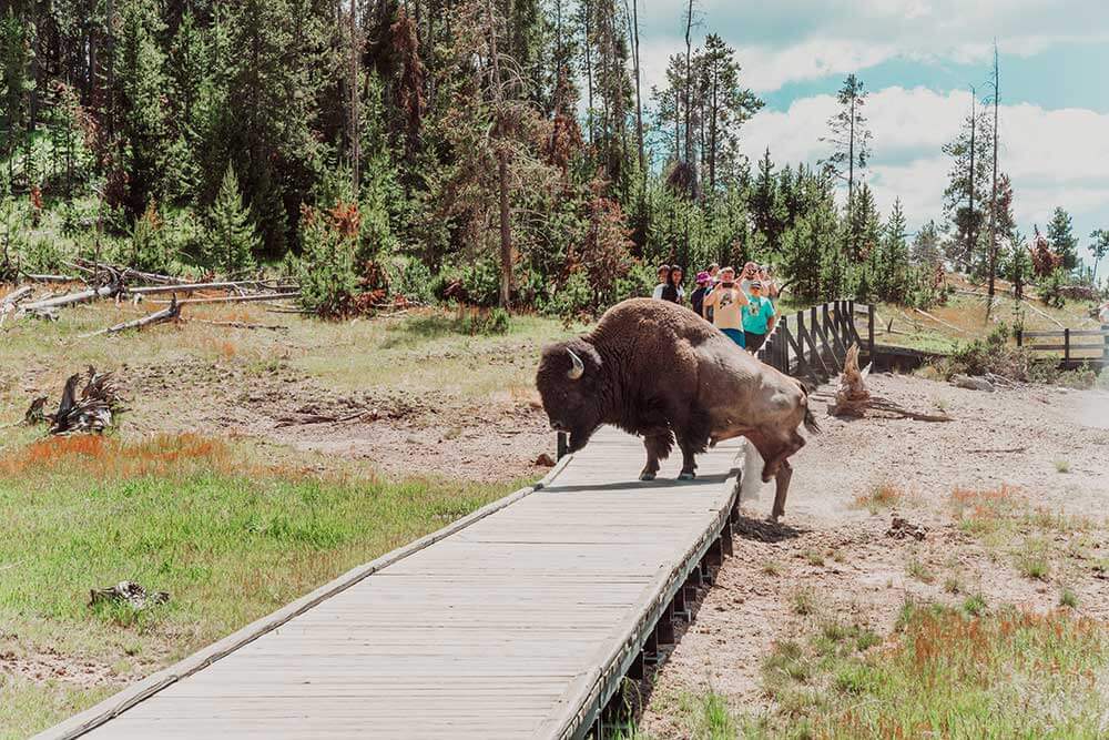
Grassland: Bison – Don’t be that Yellowstone tourist angling for a close-up. Give these fellas a wide berth and you should be fine.
Taiga: Moose – They may look harmless, but more people are injured by moose than bears every year. Give them a lot of space, make noise, and never get between a cow and her calves.
Temperate Rain Forest: Black bear – These critters rarely attack people, but a mother bear can quickly become aggressive if she has cubs in the area. Make noise while hiking to scare them off.
Tundra: Grizzly – If you find yourself facing off with a grizzly and bear spray doesn’t work, do not make eye contact or run. Play dead and hopefully he’ll lose interest.
A version of this article first appeared in the July 2022 issue of American Outdoor Guide Boundless.